Table of Contents

WMS/WMTS Services
About
WMS (Web Map Service) or WMTS (Web Map Tile Service) is a standard protocol for serving georeferenced map images over the Internet that are generated by map servers using data from GIS databases. These maps or map data layers are mostly provided by government organizations or educational institutions.
WMS/WMTS can serve almost any type of map. Beginning with topographic maps, historic maps, satellite, and aerial images, cycling routes, town plans, ending with various data layers like cadastral maps, weather services, environmental layers, etc.More info >>.
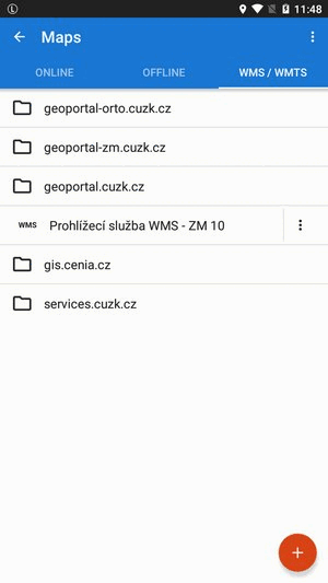
Map services are managed in the WMS/WMTS tab of Locus map manager.
- Available only with Premium
- WMS/WMTS tab can be deactivated (invisible) - to activate it, open
 Action menu, check Display WMS tab and restart Map manager
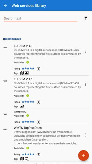
Web services library
By default, the WMS/WMTS tab is empty. If you want to use a service you have to add it first. Locus Map offers a library of worldwide WMS sources where you can select a service for adding to the app.
Service selection
- tap
 in the lower right corner:
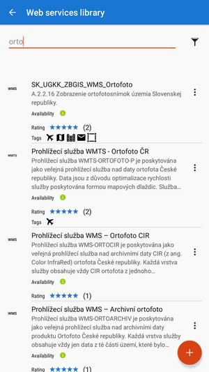
- Locus Map offers nearest sources available in your area according to your GPS location:
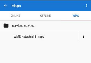
- tap the selected source - it is added to the WMS tab:
Each service has a name, a short description and a few parameters:
- Availability - links are added to the library by Locus users and not all sources are reliable. A green sign means the service availability is verified by Locus staff
- Rating - users rate the services by their relevance and quality. 5* is the best rating.
- Tags - tagged services are accurately sorted according to content criteria
Search
To specify your selection in the library, use fultext search:
Filtering
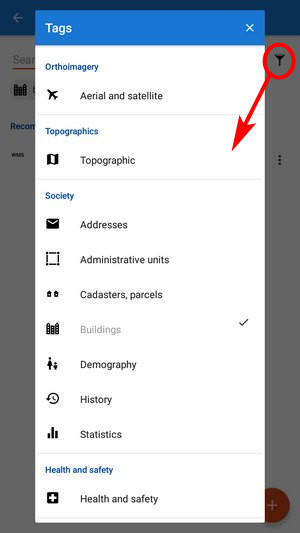
To filter the sources by tags, tap the button next to the search box:
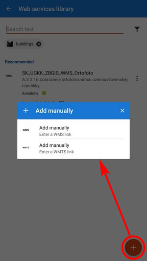
Adding source to the library
- tap again and select Add manually from the menu - WMS or WMTS source:
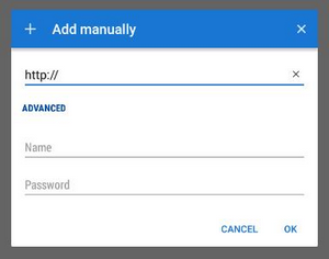
- enter the source address, name or password (if necessary) and press OK:
- the source is added to the WMS tab
- if you think other Locus users would appreciate your link too, please, ask us to add it to the public WMS library:
We'll test the link and after its validation, it'll be added to the library.
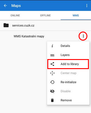
Editing source
When the source is in the library, you can edit its rating and tags:
- tap “Edit in library” in the source menu
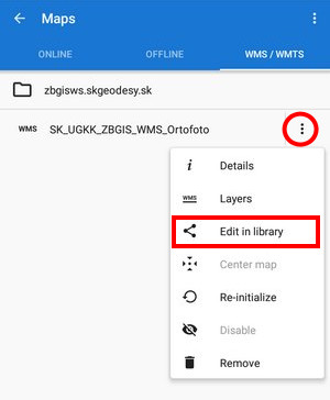
- change rating and add tags:

Other source menu items:
- Details - information about the source - provider, terms of use, contacts etc.
- Layers - available layers in the source
- Center map - aligns the map center with the cursor position in case your real location is outside the map
- Re-initialize - reloads required information from WMS server and sets the map to default values
- Disable - hides selected WMS layers in the map
- Remove - deletes the WMS source from the tab
How to display WMS
- tap the selected WMS source in the map manager
- a list of available layers and an opacity slider appears:
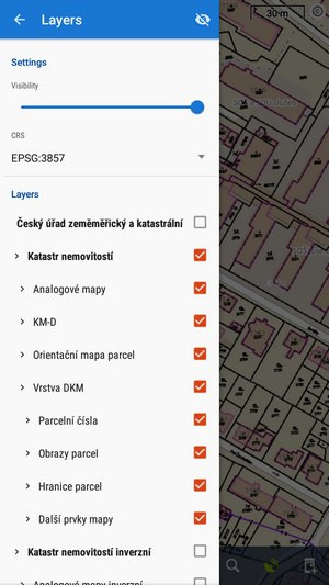
- select layers to display, adjust their visibility above the active map and confirm.
- WMS map is displayed only as an overlay above the currently active non-WMS map (online or offline) - not as a single map
- not all WMS layers may be visible in all areas and in all zoom levels.
WMS controllers
After a WMS map is activated two new control buttons appear in the upper left corner:
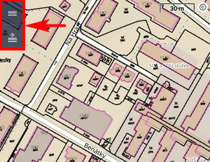
 displays the opacity slider and active WMS layers list mentioned above - check or un-check layers to display or hide.
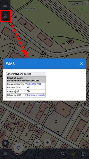
  displays a particular WMS feature information - aim the screen center at a WMS object on the map and tap the button. In case the object contains some additional information it displays in a pop-up window:
Current WMS support does not have any mechanism for tile caching. All data are stored only in your device's temporary memory.