Translated from English by gtranslate.io
Sidebar
manual:user_guide:webplanner:library
This is an old revision of the document!
Table of Contents

Library
…page is in development…
The web library contains your tracks, routes, and points. It is synchronized with the Locus Map app on your smartphone or tablet. It can be synced with multiple devices running the same Locus account.
Before you can use the library:
- Sign up to the Locus account in Locus Map mobile app.
- Subscribe to or purchase Premium Gold package.
- Run the first synchronization in the app.
- Log in to the Locus account on the web
Structure
The library uses the same structure of groups and folders as your Locus Map app with which it is synchronized:
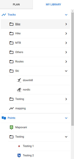
Track folder
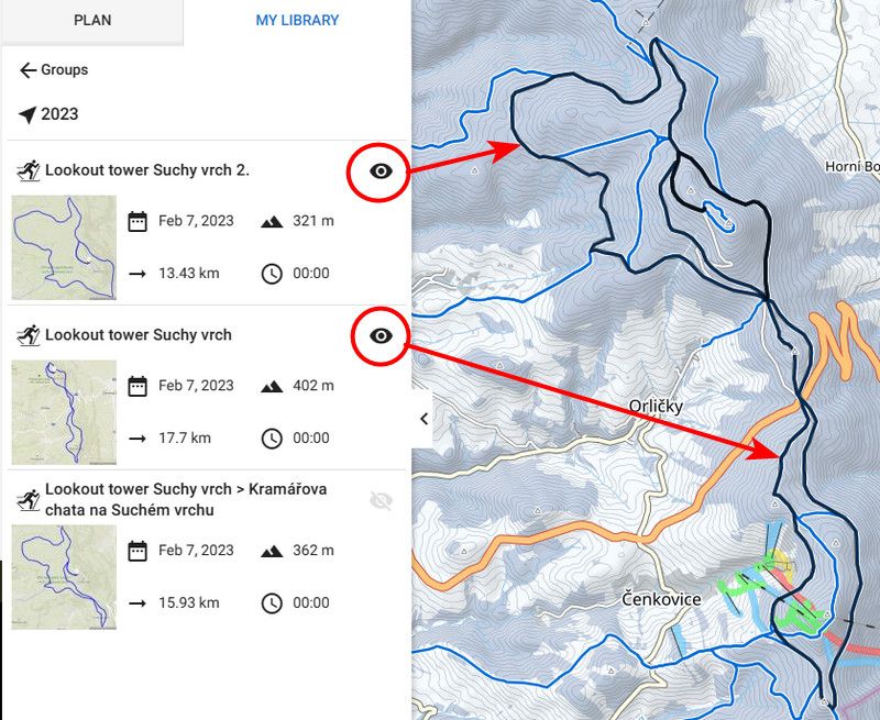
In a folder, the tracks and routes are sorted by the date of creation. Each track line displays a preview, date, elevation gain, length and time:

To display particular tracks on the map, click on their eye buttons. This way you can activate multiple tracks and routes:
Track detail
To open a track/route detail, click on the track in the folder. The detail displays a full map with the track, a chart with elevation, slope, speed and GPS accuracy (recorded track) and a panel with statistics:

Point folder
Points in a folder are sorted alphabetically. Each point line displays just an icon and the name of the point:

Points can be activated on the map only by whole folders. To do so, click the eye:

Points detail
To open a point detail, click on the point in the folder. The point is centered on the map and its detailed info is displayed on the panel:

Editing
Tracks & routes
To change the track/route's info or course, click edit:

You can edit the name and description, and change the folder and type of activity. If you want to edit the route's course, click Open in Planner. When you're finished you are given two options - to save the route as new or rewrite the original:

Points
manual/user_guide/webplanner/library.1677146908.txt.gz · Last modified: 2023/02/23 11:08 by mstupka
Except where otherwise noted, content on this wiki is licensed under the following license: CC Attribution-Share Alike 4.0 International
