Aus dem Englischen übersetzt von gtranslate.io
Benutzertools
Die Seitenleiste
Handbuch:user_guide:maps_wms
Dies ist eine alte Überarbeitung des Dokuments!
Inhaltsverzeichnis

WMS-Karten
Über uns
WMS (Web Map Service) is a standard protocol for serving georeferenced map images over the Internet that are generated by map servers using data from a GIS database. These are usually statistical maps that are mostly provided by government organizations (but also by many others). For more info, read this Wiki-Seite.
Locus-Karte offers a variety of worldwide sources that can be displayed or you can enter a direct URL to activate any WMS source you wish.
This option is fully available only to Locus Map Pro users.
Displaying WMS Maps
Auswählen
WMS-Registerkarte in the Maps Manager (the tab can be switched off so select ![]() Aktionsmenü und prüfe Sichtbare WMS-Registerkarte). The tab is empty after the Locus Map installation so you need to tell Locus Map which WMS source to display by tapping
Aktionsmenü und prüfe Sichtbare WMS-Registerkarte). The tab is empty after the Locus Map installation so you need to tell Locus Map which WMS source to display by tapping ![]() button in lower right corner:
button in lower right corner:

 displays a list of recommended WMS sources. The best way how to begin with WMS. Just select and tap Add to Locus.
 launches a dialog to enter your WMS link manually.
WMS maps display always in an overlay above your active map (online or offline).
When you launch a WMS source a Liste der verfügbaren Ebenen und einem Deckkraft-Schieberegler appears - select layers to display, adjust their visibility above the active map and confirm. Be aware that not all layers are visible in all places and in all zoom levels.
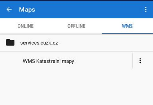
The WMS source appears in your Maps Manager WMS tab in a folder named by its provider. Langes Tippen at a source displays an information window about the source provider, author, contacts, possible fees and further description.
 Aktionsmenü at the WMS source provides following:
- Details - information window mentioned above
- WMS-Ebenen - Verfügbare Ebenen in der Quelle
- Center Map - centering the map at the screen center of your phone in case your position is outside the map
- Karte neu initialisieren - lädt die erforderlichen Informationen vom WMS-Server neu und setzt die Karte auf die Standardwerte
- Deaktivieren - blendet ausgewählte WMS-Layer in der Karte aus
- Löschen - deletes the WMS source from the list
WMS Map Screen
After a WMS map display two new control buttons appear in the upper left corner:
 zeigt das Deckkraft-Schieberegler und Liste der aktiven WMS-Layer - check or un-check layers to display or hide.
  zeigt a an bestimmte WMS-Funktionsinformationen - aim the screen center at a WMS object on the map and tap the button. In case the object contains some additional information it displays in a pop-up window.
WMS Maps Sources
 Locus-Karte supports WMS specification versions 1.1.1, 1.3.0
Die aktuelle WMS-Unterstützung verfügt über keinen Mechanismus für das Caching von Kacheln. Alle Daten werden nur auf Ihrem Gerät gespeichert temporärer Speicher.
Empfohlen WMS Map Sources List >>
Verwenden Sie die Add to Locus links directly in your phone web browser (access to this page is also from your Locus Map Manager WMS tab).
Manual/user_guide/maps_wms.1448267612.txt.gz · Letzte Änderung: 2015 11:23 (externe Bearbeitung)
Sofern nicht anders angegeben, ist der Inhalt dieses Wikis unter der folgenden Lizenz lizenziert: CC Namensnennung – Weitergabe unter gleichen Bedingungen 4.0 International
