Translated from English by gtranslate.io
Sidebar
manual:user_guide:geocaching:tools
This is an old revision of the document!
Table of Contents

Geocaching Tools
About
Menu > More > Geocaching tools
Geocaching tools contain many useful options for some special geocaching cases:
- Graphic computations - for better solving some of mystery caches
- 161 m circles around caches - to secure a correct radius from another cache when creating a new one. More about this see here >>
- Already created field notes check
- etc.
Tools
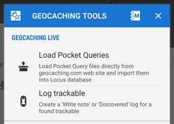 Load Pocket Queries - see Pocket Queries in Import chapter. This option is available only to Locus Map Pro users
- Log trackable - enables logging found trackable item directly from the app (internet connection required). This option is available only to Locus Map Pro users. More about trackables >>
- Draw circle - draws a circle with defined radius and color/opacity around any selected place on the map
- Line tools - draws a line between two defined coordinates or calculates an intersection point of two lines
- Middle point - sets location of two points and calculates exact center between them
- Projection - calculates a new point if its distance and azimuth is known and draws it on the map. This function is available also in Location selector.
- Load all waypoints - displays all waypoints of visible geocaches on the map
- Cache radius limit - according to Geocaching.com rules, physical parts of individual geocaches may be placed at least 528ft/161m from each other. This function helps visualize such area. More about this see here >>
How to remove items drawn by the geocaching tools:
- tap the
 Hide items button in Data manager/Items tab or
 - long-tap the Data manager button on the map screen and select Remove temp map items or
- add Remove temp map items button to the Function panel
manual/user_guide/geocaching/tools.1429780055.txt.gz · Last modified: 2015/04/23 12:07 (external edit)
Except where otherwise noted, content on this wiki is licensed under the following license: CC Attribution-Share Alike 4.0 International
