Translated from English by gtranslate.io
Sidebar
manual:user_guide:points:management
Table of Contents

Points Management
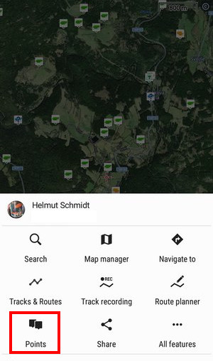
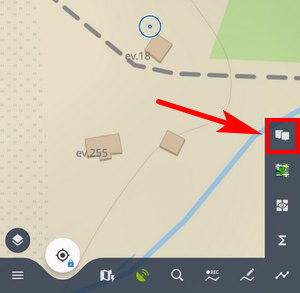
All user points in Locus Map are managed in the Points manager. You can access it:
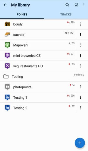
Points are stored in folders from where you can visualize them on a map, edit them, copy, etc. Folders can be put into groups:
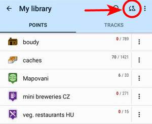
Cloud sync
Available only with Premium Gold
To sync your points manually with the cloud, tap the button in the topbar:
Your points are then automatically synchronized (saved to and downloaded back) with your personal web library via Locus cloud service. This happens after every change of your data - when a point is created, imported etc. More details here >>
It is necessary to perform the first synchronization with the cloud manually. This way your personal web database is created.
Folders
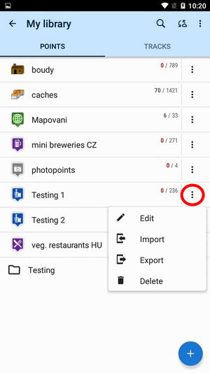
Each folder line consists of an icon (1), a folder name (2), number of visible/stored points(3) and and ![]() action menu button (4):
action menu button (4):
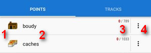
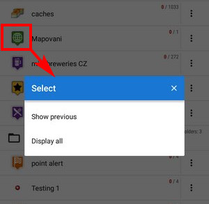
Icon (1) - tapping it opens the selection to load (visualize on map) all previously visible points or all points in the folder. Once all points were selected, it just switches between all visible/all invisible:
Folder name (2) - tapping it unfolds the folder:
![]() action menu button (4):
action menu button (4):
 Edit - here you can change folder icon, edit name and style on map or insert folder into a group if there is any created
 Import - add new points into the folder by import from outside of Locus
 Export - exports all points in the folder into a file and/or an online service, see more in Points Export
 Delete - deletes the whole folder including all points in it
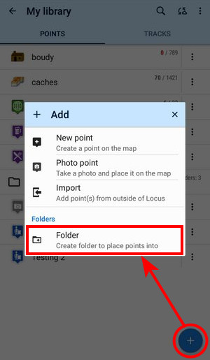
How to add a folder
- tap
 and select Folder:
- select icon (optional - select from Locus style and Garmin style icons) and name the folder
- set style and behavior of point labels on the map screen (optional)
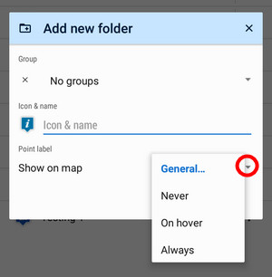
Global settings - the point labels/screens behavior submits global settings made in Settings > Points&Tracks; Never - point labels are activated only by tapping the points; On hover - point labels appear when the map cursor hovers over the point; Always - point labels are permanently visible - tap ADD to confirm
Groups
Available only with Premium
Folders can be put into groups as another level of data structure. Each group line contains the group name and the number of folders allocated in it. Before adding a folder to a group, it is necessary to create one.
How to add a group
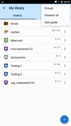
- tap the submenu in topbar and select Groups
- tap + and create a new group
- new group appears in the point manager:
How to add a folder to a group
- open the edit menu of a folder
- select the group you want to put the folder into
- save
Points folder
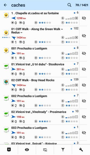
After tapping a folder name in the manager the points display in a vertical list:
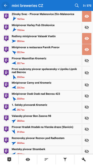
Its topbar displays visible/total number of points:
Each line consists of:
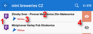
- icon (1) - either the same as the folder in case the point is created by you or different in case the point is imported - tapping the icon displays the point on the map
- point name (2) - tapping it opens a point detail screen
- bearing and distance (3) to the point from the current position of the map cursor
 visibility button (4) - switches point in/visibility on the map - button is highlighted when the point is shown on map

How to display points on map
Single point
- tap the icon of the point in the point list
OR - tap the “eye” button:
To remove the point from map (not from the database), tap ![]() again.
again.
Multiple points
Use one of multiselecting options:
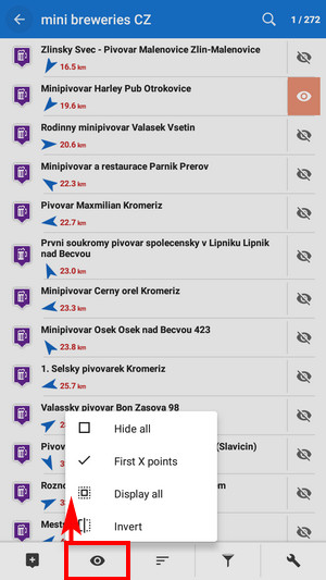
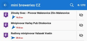
- Hide all - makes all points in the folder invisible on the map
- First X points - shows a predefined number of first points in the list (50, 100, 200… points)
- Show all - makes all points in the folder visible on the map
- Invert - inverts the current selection, useful when you want to select almost all points except some. Select those and then invert the selection.

How to sort points
There are several options:
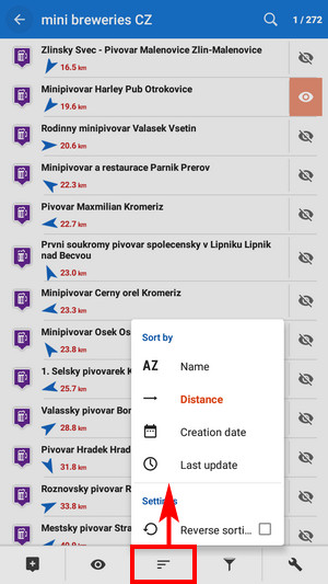
- Sort by name - sorts points alphabetically
- Sort by distance - sorts points by distance from actual map cursor position (or actual GPS position when fixed and centered)
- Sort by creation date - sorts points by their creation date/time
- Sort by last update - sorts points by the date/time of their last update
- Reverse sorting - switches sorting into reverse mode
Geocaching - folders with geocaches contain this option for further sorting methods, see more in Geocaching

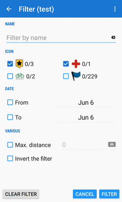
How to filter points
- tap filter button
- select criteria
- name - filter out points based on a given string of characters - full-text check
- icon - filter out points with particular icons
- date - filter out points created in a particular term from-to
- max. distance - define the maximum distance of filtered points from the map cursor
- invert the filter - inverts the filter settings
- tap FILTER:
Geocaching tab - appears when geocaches are filtered. Contains further filtration methods specific for geocaching, see more in Geocaching
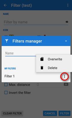
Save filter for later use
With a saved filter you do not have to set it up again every time you need it. All is done in the filter manager:
 Saved filters can be overwritten by newer settings or deleted:
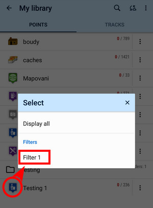
 You can quickly apply a saved filter when displaying a whole folder of points:

Copying, moving, deleting, etc.
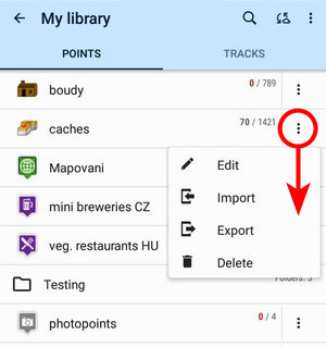
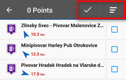
More managing tools can be found under the tools button:
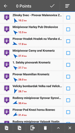
To apply a tool to points, select points by checking single ones or use multi-select and sorting in topbar:
Copying

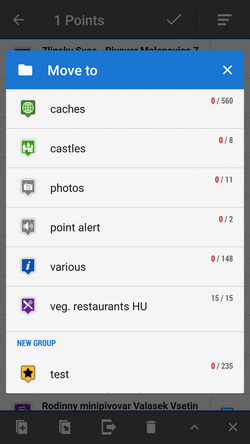
Moving
Exporting

Deleting
Other tools
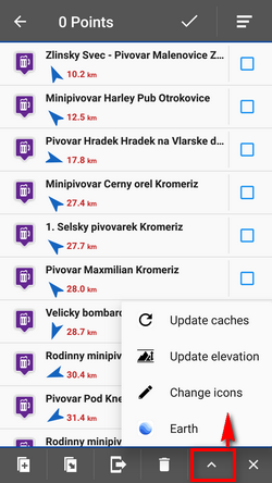
- Update elevation - updates elevation of selected points with downloaded SRTM data
- Change icons - changes icons of selected points
- Earth - exports selected points into Google Earth if it is installed on the same device
- a few geocaching tools if the folder contains geocaches - Update caches, GC Offlinizer or Load GC Vote, see more in Geocaching
 - cancels Tools menu screen
Point label
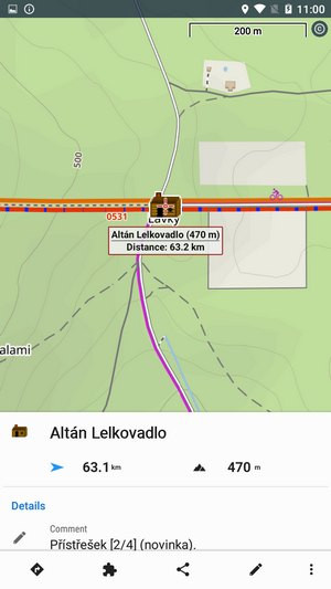
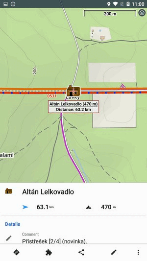
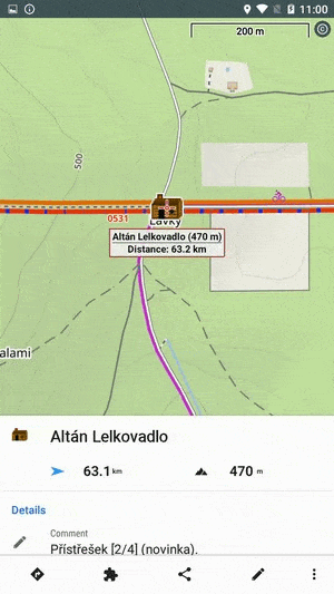
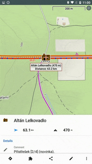
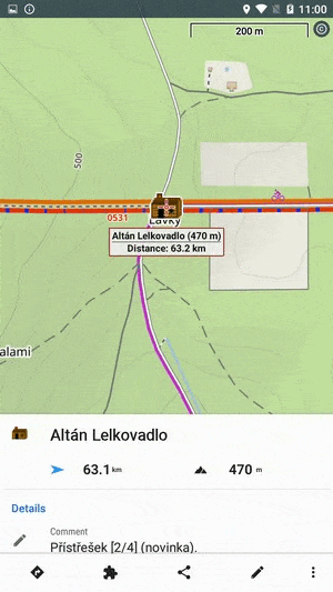
Appears when you move the map cursor across the point icon on map:
It contains the point name, distance from the current position, elevation (if relevant data are available) and a thumbnail of an attached image (if there is any).
Tapping the point icon on the map slides up the Point detail panel:
Point detail panel
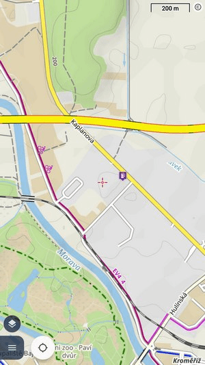
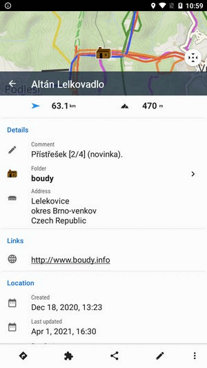
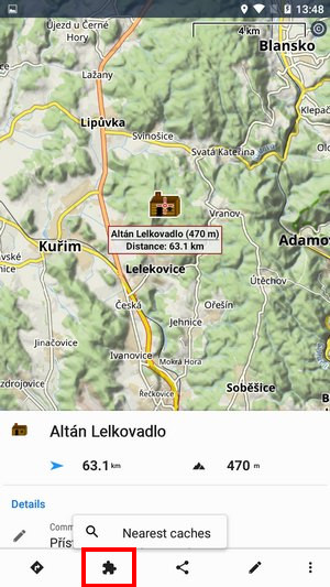
When you tap a point in the point manager folder, a screen with detailed information about the point emerges. Its upper part is filled by a map preview with the point. Tap the centering button to place the point in the middle of the main map screen:
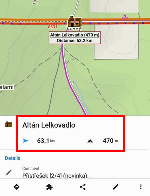
When you tap a point on the main map screen, a panel with detailed info about the point slides up from the bottom:
If you shift the map out of the point's location, Locus shows a pointer on the location of the selected point so that you always know where the point is. By tapping the pointer, you center the point back on the screen:
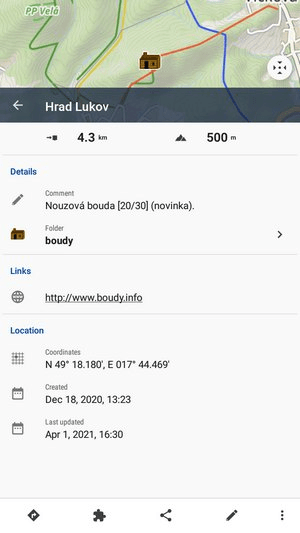
Basics, description and other info
- name, direction, distance and elevation are visible right after the panel slide up:
More information emerges when you slide the panel a bit more up: - Description, folder, links, location… are lined up below the main info:
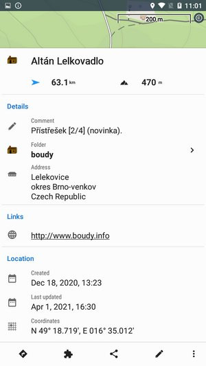
Folder - tapping opens the folder in the point manager. Coordinates - long-press copies the coordinates to the clipboard
Tools
The bar with tools is placed at the bottom of the panel. It contains several groups of tools:
Navigation options
- Plan route to - opens the route planner and quickly plans a route to the point using the last used routing profile:
You can go on planning the route, change profiles, add more points etc. - Navigate to - opens a routing profile selection, generates a route, and starts navigation to the point:
- Guide on - starts guidance to the point in a beeline direction (recommended when the point is placed off road):
- Street View - opens Google Street View app and shows the point in it (if available)
- Navigation apps - opens a list of installed applications that are able to navigate to the point (Google Maps, Komoot, Sygic, etc.)
Add-on options
The contents of this group depend on the installed add-ons. The most common options regard the Geocaching4Locus add-on.
Sharing options
Opens a selection of point sharing options which are the same as for the map cursor (except the basic geocache info sharing):

More about particular sharing options HERE >>
Editing options
Opens a dialog screen where you can edit any information about the point - its icon, name, folder, description… even its location:
- Altitude - if this parameter is empty tap the GET button to acquire elevation from the offline data (Premium only)
Attachments
Contains a list of attached files. To add some, tap the “+”. List of adding options emerges:
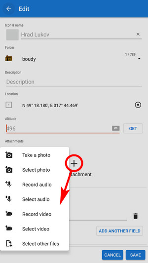
- Take a photo - takes a picture with your phone or tablet camera
- Select photo - selects a photo in your phone memory - the attached photo can be used as the point icon - tap the menu next to the photo and select Set as icon
- Record audio - makes a voice recording by the phone or tablet microphone
- select audio - attaches an audio file from your phone memory
- Record video - makes a video recording by the phone/tablet camera
- Select video - attaches a video from your phone memory
- Select other files - selects other files in your phone memory to attach to the point
Without Premium, the number of attachments for one point is limited to two.
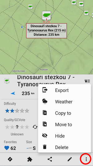
More options
…offers the same editing/copying etc. options as the folder tool menu, plus local weather forecast:
manual/user_guide/points/management.txt · Last modified: 2024/04/10 15:36 by mstupka
Except where otherwise noted, content on this wiki is licensed under the following license: CC Attribution-Share Alike 4.0 International
