Translated from English by gtranslate.io
Sidebar
manual:user_guide:maps_tools:overlays
This is an old revision of the document!
Table of Contents

Map Overlays
About
- Menu > More functions > Map Overlays
This feature enables laying two maps over each other in semi-transparent mode so that it is possible to compare their details, coverage, accuracy etc. or two maps can complement each other.
This option is available only to Locus Map Pro users.
1. Select your base map
Choose from your Map manager:
- Online maps - all except SmartMaps
- Offline maps - vector maps (.MAP format), SQLite, MBT or GEMF (other formats are not supported)
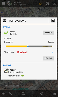
2. Select your overlay map
- Start the feature in Menu > More functions > Map Overlays.
- Switch it on.
- Select the overlay map - online or offline - the same formats as for the base map are supported.
3. Set visibility and blend mode
- Adjust visibility with the slider from opaque to transparent.
- Blend mode of the two maps is disabled by default. If necessary, select one from the menu - try which one suits you the best.
- Close the dialog.
 If you want to switch the function off, switch it off (or tap Remove) in the Overlay settings dialog and close the window.
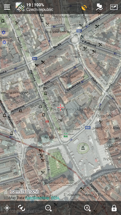
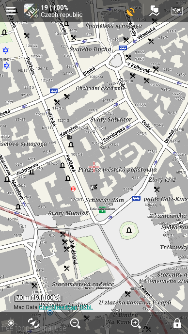
Example
LoMaps center of Prague with and without satellite image map overlay:
manual/user_guide/maps_tools/overlays.1464087595.txt.gz · Last modified: 2016/05/24 13:59 (external edit)
Except where otherwise noted, content on this wiki is licensed under the following license: CC Attribution-Share Alike 4.0 International
