Translated from English by gtranslate.io
Sidebar
manual:user_guide:points:locus_maps_pois
This is an old revision of the document!

LoPoints
page in maintenance
About
LoPoints are dynamic points of interest that can be displayed above any map. Each LoPoint marks the location and category of a particular place and contains additional information - e.g. opening hours, WWW, phone number, and other attributes. LoPoints can be navigated to and guided similarly to Locus user points. LoPoints are based on OpenStreetMap and Wikipedia data.
Online
Online LoPoints are loaded from the internet and contain also photos from Wikipedia and from Locus users:

They can be turned on/off from the content panel:

Offline
Offline LoPoints are an integral part of LoMaps but can be also displayed above any other map. They can be turned on/off from the content panel as well.
Browsing
You can browse offline LoPoints by categories, select a category and highlight it on the map.
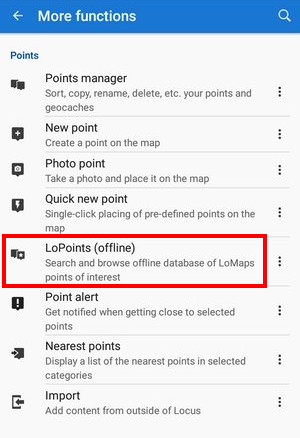
- Menu > All features > Points > LoPoints (offline)
- Points around - displays a list of all nearest points across all folders around your current location or position of the map cursor
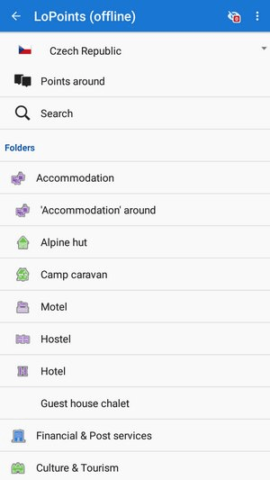
- Select a category - Accommodation, Financial&Post services, Culture&Tourism, Public services, Hiking&Cycling, Nature, Emergency&Health, Places of Worship, Food&Drink, Shopping, Sport leisure, Car services, Transportation, etc. Each category is divided into subcategories.
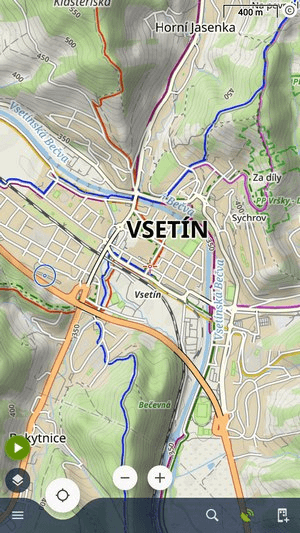
- Highlight the category on map by tapping
 in the topbar (showing also number of points in the selected category):


LoPoints can't be exported.
Search
You can search for LoPoints or their categories both from the LoPoints browser
 and from the general Search
 It works full-text so e.g. keyword “rests” returns all points with “rest” in their name, description or amenity. The search results can be highlighted on the map in the same way as described above.

Deactivation
LoPoints can be deactivated - hidden on the map. Tap ![]() in the topbar and uncheck Display on map.
in the topbar and uncheck Display on map. 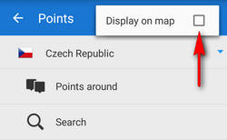
LoPoints database (mapname.osm.db) can be used only when a corresponding LoMap map file (mapname.osm.map) is present in /mapsVector/ directory. If the map file is removed (e.g. due to saving space for use of other map) the POI file cannot be initialized.
manual/user_guide/points/locus_maps_pois.1655382631.txt.gz · Last modified: 2022/06/16 14:30 by mstupka
Except where otherwise noted, content on this wiki is licensed under the following license: CC Attribution-Share Alike 4.0 International
