Translated from English by gtranslate.io
Sidebar
manual:user_guide:tracks:about
This is an old revision of the document!
Table of Contents

About Tracks & Routes
page is being rewritten
What is the difference between a route and a track?
Tracks act like breadcrumb trails, allowing you to see where you or another individual traveled in the past. Tracks contain track points, not waypoints or points of interest. They provide a record of where you have been and when to later determine your path and speed.
Locus Map can record tracks and import already recorded tracks from other sources.
Routes are generally made up of a series of significant points along your path. Locus Map will tell you the bearing and distance to the next point in sequence as you navigate along your route. Each point is usually named (in fact, a route is usually just a sequence of waypoints). Routes can be planned directly in Locus Map point by point or Locus Map can calculate it for you.
Actually Locus Map can transform a previously recorded track into a route and navigate along it.
Tracks & routes on map
…to be continued…
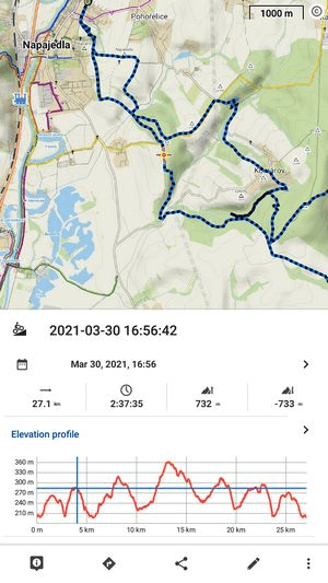
Track & Route detail panel
When you tap a track on the map, the detail panel slides up from the bottom:
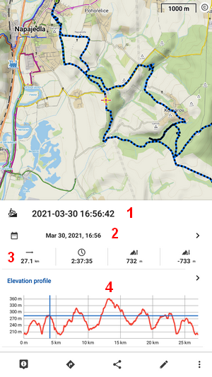
Statistics
The upper part contains the track name (1), date of creation (2), and basic stats of the track/route (3). Tapping the arrow button on the right maximizes the stats screen:
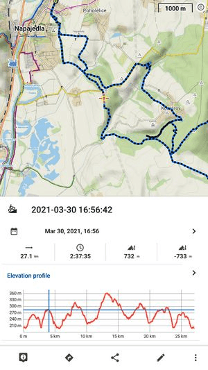
Elevation chart
The elevation chart (4) displays the position of the tapped trackpoint. Maximizing button unfolds the chart to the more detailed version:
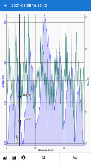
The trackpoint is highlighted there too, including related graph values (here with elevation and slope %).
The bottom toolbar:
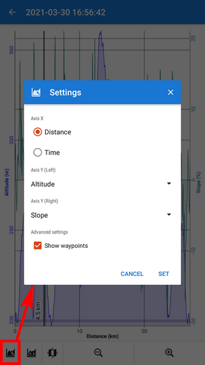
 graph settings - here you can set X-axis parameter (distance/time) and two parameters for the Y-axis (altitude, slope, speed, heart rate and cadence - if appropriate sensors are connected)
 returns the whole graph into the box when it is zoomed out
 if you tap on the chart once more, this shows the trackpoint on the map
- +/- zoom the chart in/out
More details emerge when you slide the track detail panel further up:
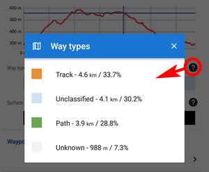
Way types and surfaces
This feature is available only to Premium Gold subscribers
The way types and surfaces along the route are displayed only if the route is planned in the Locus route planner:
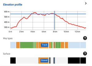
When you tap the way type or surface graph the description is shown. ![]() shows the way types/surfaces along the route in %:
shows the way types/surfaces along the route in %:
Waypoints
…more to come…
Trackpoint detail
![]() in the bottom toolbar opens the selected trackpoint detail:
in the bottom toolbar opens the selected trackpoint detail:
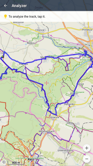
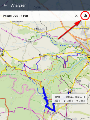
Track/route analyzer
When you need to know statistics and charts of a particular part of the track or route, open the track in this tool. It's available in the tool menu:

- tap the track on the place from which you want to define the span
- tap the other point of the span. You can repeat this step and change the span definition.
- check the general stats and elevation chart in the bottom bar
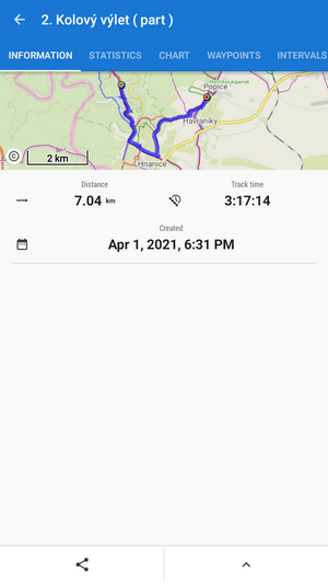
When you want to see detailed statistics and charts, confirm your selection:
The selected track part is displayed in a new detail window with info, stats and chart tabs:
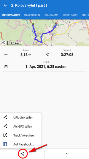
To share the track part, select an option from the Share menu:
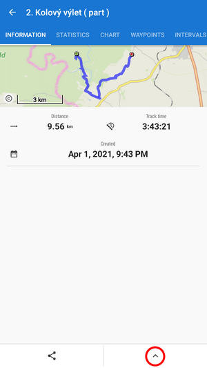
To make a copy of the track part, to export it, compute the area covered by it or calculate its estimated travel time, select from the tool menu:
manual/user_guide/tracks/about.1623924119.txt.gz · Last modified: (external edit)
Except where otherwise noted, content on this wiki is licensed under the following license: CC Attribution-Share Alike 4.0 International
