Translated from English by gtranslate.io
Sidebar
Table of Contents
None, inaccurate or wrong GPS location and elevation
Important!
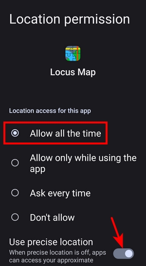
Get Locus Map permission for all-time access to location and exclude it from all means of battery optimization so that the app can run and access location data in the background. Instructions on how to do it are summed up here or here.
Locus Map processes location and elevation gain from the data it receives from your phone GPS and other location/orientation sensors. If the data is incorrect or contains deviations, the resulting location fix and elevation gain are incorrect. Locus Map, however, offers a few methods for limiting these deviations.
No location at all
There are a few reasons why the app might not show your location on the map:
Access to GNSS data is turned off in Locus Map
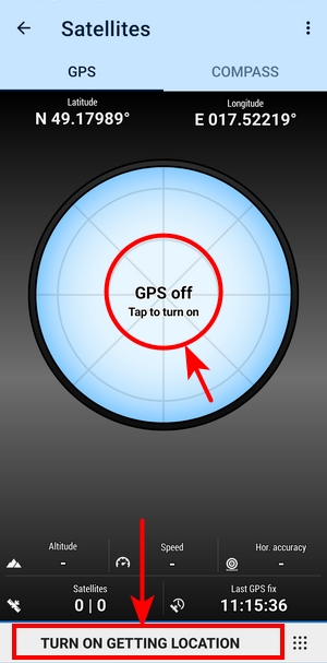
- the GPS indicator is white:
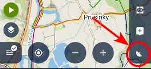
- tap it and then tap either the skyplot or the button to turn on getting location:
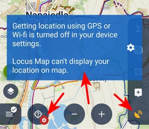
The phone's GNSS is turned off
- the GPS indicator is orange, there is a badge on the centering button and a warning emerges:
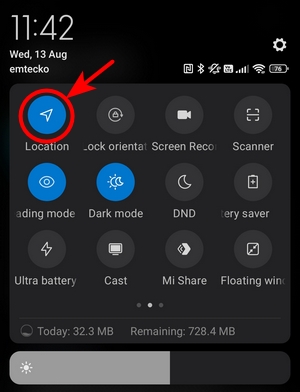
- turn on your phone's GNSS:
No location permission for Locus Map
- the GPS indicator is white and tapping the centering button or the GPS skyplot displays a warning:
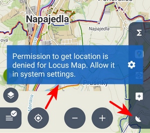
- in system settings, allow Locus Map access to precise location all the time:
Light deviations
Open Locus Map settings > GPS&sensors and set the following
- Location filter > select medium or heavier filter
- Google Services assisted location > turn it ON (or OFF, it depends on your device)
- Altitude manager > settings tab > SRTM data - select Optimize GPS values
- Altitude manager > settings tab > Pressure sensor > turn ON (if available)
- Altitude manager > settings tab > Altitude filter - select medium or heavier filter
Stronger deviations
Sometimes it happens that the GPS chip is malfunctioning or terrain/weather conditions are so demanding that elevation data is incorrect even after applying the measures mentioned above. Then try the following:
- Open Locus Map settings > GPS&sensors > Altitude manager > settings tab > SRTM data - select Replace GPS values - this option calculates elevation gain from offline elevation data without using GPS
Custom altitude threshold
Those who are still unsatisfied with the result can change the elevation gain calculation by applying a custom altitude threshold:
- open Expert settings > Customize altitude threshold > enable it
- open a track or route detail > select Edit from the bottom menu
- change altitude threshold with the slider
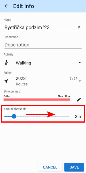
By default, the altitude threshold in the app is not fixed. It is based on the source of the elevation. App decides by following the check (in this order):
- if you use a pressure sensor, the app sets the threshold to “2”
- if you use elevation data (enabled in “Altitude manager”), the threshold is set to “3”
- if you have Android 12+, the threshold is set to “5”
- otherwise it is set to “10”
- generally, the default value is “5”. It should be set to all imported tracks or to old tracks recorded before this parameter was introduced

