Translated from English by gtranslate.io
Sidebar
manual:user_guide:items:management
This is an old revision of the document!
Table of Contents

Managing map items
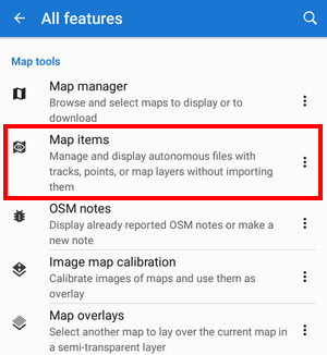
Map items are managed in Map items manager that can be switched on from the main menu by default:
- Main menu > All features > Map tools > Map items
Adding
You can add autonomous geodata files to Locus Map by loading from several sources:
External storage

- tap

- select storage - local directory, system file manager, Dropbox, Google Drive, OneDrive or a remote file
- select the file - Locus can process KML, KMZ, GPX, JSON and ZIP files
A feature
Some Locus features output is technically a map item - for example a calibrated map image.
Locus Store
Some routes downloaded from Locus Store are technically map items too, for example, Via Francigena
Map items manager
It contains a list of folders and items. Folders are created automatically during adding an item.
Map item folders
 Each item folder line consists of:
- icon - indicates the origin of the folder
- folder name - in case of automatically created items it displays the service or feature name. Folders can be manually created or edited only outside Locus in your device file manager - in /Locus/mapItems directory
- date of creation, data size
 action menu:
- hide all - deactivates all items from the folder
- delete - removes the whole folder provided it is empty - included items must be deleted first
![]() topbar menu:
topbar menu:

- Display all - displays all map items in the list on the map screen
- Hide all - aborts displaying of all map items on the map screen
- Open in a file browser - opens an offer of installed file browsers to open the Locus/mapItems directory
- Clear map screen - removes all temporary objects from the map - map items, objects displayed by the Content panel, by geocaching tools etc.
Map item line
 Consists of the same, plus
 ![]() button that changes into
button that changes into ![]() when tapped - map item is activated, i.e. visible on map
when tapped - map item is activated, i.e. visible on map
![]() action menu is different:
action menu is different:

- Details - displays item detail screen - filename, preview (centers item on the map), distance, min altitude, max altitude, date of creation, size, description etc.
- Center item - active only when the item is active - places the item in the center of the map screen
- Import - launches import of the item, as it is described here >>. After the import the item's content does not function as an autonomous object, it is implemented in the application data manageable in My library.
- Delete - removes the item from the items list and from the MapItems directory
manual/user_guide/items/management.1732026519.txt.gz · Last modified: by mstupka
Except where otherwise noted, content on this wiki is licensed under the following license: CC Attribution-Share Alike 4.0 International
