Translated from English by gtranslate.io
Sidebar
manual:user_guide:mainscr_lpanel
This is an old revision of the document!
Table of Contents

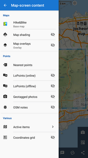
Content Panel
…reconstruction…
The content panel controls what is displayed on the main screen:
- maps
- tracks and routes
- points of interest
- other layers
Maps
Quick switch
…is opened by tapping the selected map title:
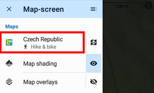
It offers maps in two sections:
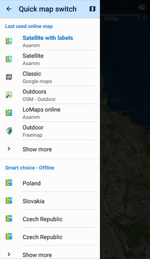
- last used online maps - displays a few online maps that were used during the last app sessions. You can select a map by tapping. Show more opens the map manager > online tab for the full selection of available online maps.
- smart choice - offline - a list of available offline maps nearest to the app cursor location. You can select a map by tapping. Show more opens the map manager > offline tab for the full selection of downloaded offline maps.
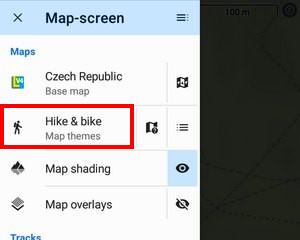
Map themes
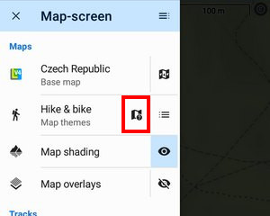
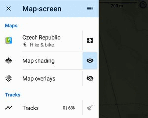 If the active map contains themes, this switch opens the theme selection options:
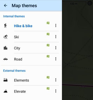
Theme selector
With this you can select internal (LoMaps) or external themes for the map:
Map legend
This switch opens the LoMap legend.
Layers
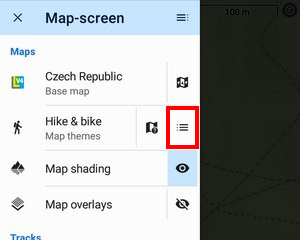
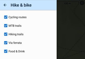
Each theme contains a selection of layers that can be displayed or hidden. This button opens the selection.
Map shading
Locus provides several types of map (or terrain) shading for a better understanding of the terrain relief.
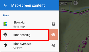
- tapping the feature title opens the map shading setup
 de/activates shading
Map overlay
Here you can set up another map to lay over the current one.
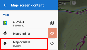
- tapping the feature title opens the map overlay setup
- de/activates the overlay
Points
Nearest points
By tapping this option you open a panel with points located nearest to the map screen cursor:
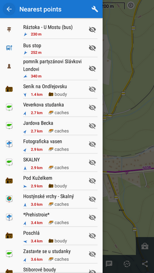
They are sorted by the distance from the cursor location. You can filter the nearest points by several categories:
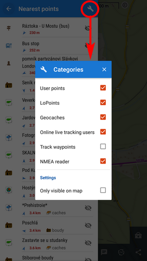
- User points - your downloaded, imported or created points, see the points manager
- Geocaches - downloaded geocaches
- Online live tracking users - active only when you have live tracking on. Displays users according to your mode of connection - public or in your private group
- Track waypoints - waypoints on nearest tracks
- NMEA reader - objects located by an NMEA reader
- Only visible on map - when checked, the filter displays only points visualized on the map
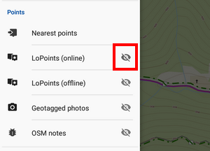
LoPoints online
Activating or deactivating LoPoints (OSM-based points of interest) available online.
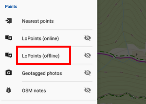
LoPoints offline
Activating or deactivating LoPoints (OSM-based points of interest) available offline as a part of downloaded LoMaps.
- tapping the title opens LoPoints manager
- de/activates LoPoints on the map
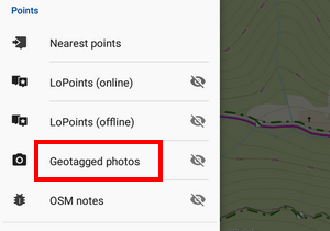
Geotagged photos
Locus Map can display your geotagged photos above the map:
- tapping the title
 opens the selection of available photo folders. Your camera photos are usually in the DCIM folder:
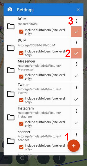
- (1) Android 5-10 only - opens the file browser where you can select a custom photo folder
- (2) checked folder is active
- (3) removes the folder from the list
- de/activates geotagged photos on the map:
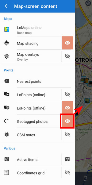
OSM notes
With OSM notes you can notify OSM community of map errors.
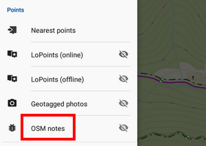
- tapping the title opens OSM notes setup
- de/activates OSM notes on the map
Active items
Locus Map can display autonomous geodata files above the map - map items. Here you can manage which files are active, i.e. visible on the map, and you can set their opacity:
Coordinates grid
Tapping the option opens a selection of available grids:
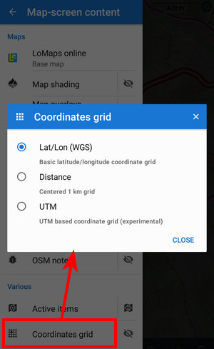
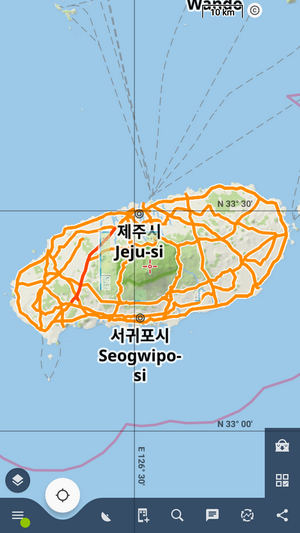
Tap ![]() to display the grid of coordinates. This is default latitude/longitude:
to display the grid of coordinates. This is default latitude/longitude:
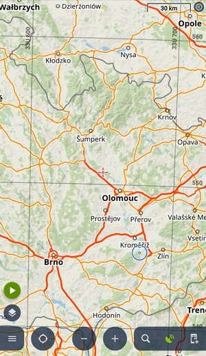
 UTM:
UTM:
 Centered 1 km grid:
manual/user_guide/mainscr_lpanel.1691750651.txt.gz · Last modified: 2023/08/11 12:44 by mstupka
Except where otherwise noted, content on this wiki is licensed under the following license: CC Attribution-Share Alike 4.0 International
