Translated from English by gtranslate.io
Sidebar
manual:faq:how_to_navigate_offline
Table of Contents
Routers, their setup and use
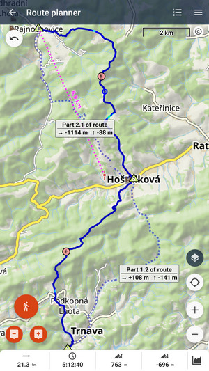
The Route Planner and Navigate to use services of route-generating engines called routers. The router generates a route based on selected profiles and their parameters. Each profile relates to an activity (hiking, nordic skiing…) or a means of transport (bike, car…).
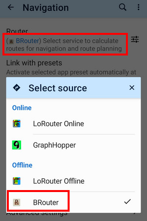
You can use three routers in Locus Map 4:
- LoRouter - built-in router
- GraphHopper - external service
- BRouter - external cooperating app
All routers use the OSM routing database and are independent on an active map.
LoRouter
Built-in router, available in online and offline (Premium Gold only) variants. The online LoRouter is the default router of Locus Map 4.
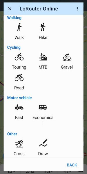
LoRouter offers 9 internal routing profiles divided into four categories:
Walking
 Walking - perfect choice when you want to get the shortest way from one place to another on foot. Ideal for use in cities.
 Hiking - choose this when you need a route for a hike. This profile prefers hiking trails, and forest paths and doesn't evade hills.
Additional parameters
Both walking profiles offer the wet conditions option selecting less muddy surfaces where possible.
Customized ETA
Both walking profiles provide an option to customize the way the app calculates your estimated time on the route. The calculation is based upon your average speed on flat ground:

Cycling
 Touring - a basic bike profile preferring cycling paths and less hills for a comfy ride. Top choice for long-haul bike tourists.
Aditional parameters: you can allow or disallow ferries and tunnels
 MTB - a profile for mountain bikers of all styles and skill levels. Basically, the profile prefers paths, tracks and trails and doesn't evade climbing.
Additional parameters: Terrain level - you can control the difficulty of the route based on its surface character, gradient and elevation profile. 5 levels are available - smooth, rolling, varied, technical and rugged. You can also dis/allow ferries or turn on wet conditions when you are heading out after rain.
 Gravel - profile preferring gravel hilly roads and tracks with compacted surface.
Additional parameters - besides ferries and wet conditions you can allow/ban stairs on the route (to carry your bike to shortcut the route).
Customized ETA - also these cycling profiles provide an option to customize the way the app calculates your estimated time on the route. The calculation is based upon your average speed on flat ground typical for the bike type:

 Road - top choice for fast riders preferring tarmac roads.
Additional parameters - besides the ferries, tunnels and steps you can turn on/off cycleway preference.
Customized ETA - road cycling profile provides an option to customize the way the app calculates your estimated time on the route. The calculation is based on your power performance in Watts:


Motor vehicle
 Fast - basic car profile for the fastest routes between two destinations.
 Economical - profile for the shortest routes with low-speed limits for economical gas consumption
Additional parameters
Both car profiles allow for control of ferries, tolls, highway access and unpaved roads for those with terrain vehicles
Other
 Cross country - profile generating routes along marked and/or groomed ski tracks. Fully functional, primarily in winter sports resorts. This profile has no additional parameters.
 Draw manually - mode for manual drawing on the map regardless of the roads and paths. Useful in places not covered by routing data - when you need to go off-road and off-path (to cross a stream without a bridge or make a shortcut across a meadow…).
Custom routing profiles
Besides the LoRouter profiles embedded directly in Locus, it is also possible to use profiles provided by other users or developers as the .BRF files:
- copy the BRF file into /Locus/router/profiles2 directory
- restart the app
- launch route planner > open the route profile selection > select LoRouter offline > tap ADD NEW in the topbar
- fill in the name, icon of the new profile and select the BRF-based custom profile from the list
- confirm
For example this way you can add a canoeing profile to the planner (the BRF is from BRouter):

Poutnik's GitHub page provides further information on this as well as many ready-to-use profiles.
Warnings
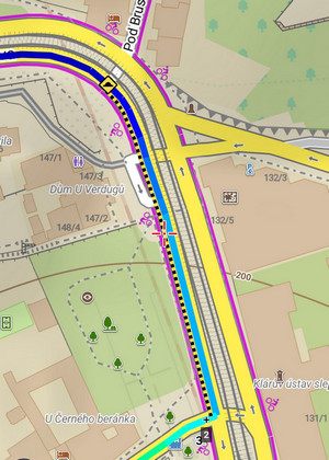
LoRouter generates warnings for various pitfalls on the route – for challenging terrain, heavy traffic, barriers, tunnels, unprotected railway crossings, and so on. And that’s both in the route planner and in the quick route calculation for direct navigation to the destination:
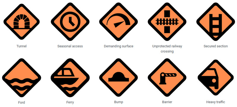
Some warnings have three color-differentiated levels – from the least to the most serious warning:

If a warning concerns entire sections of the route, e.g., challenging surfaces or heavy road traffic, it also has a zonal variant, so you know exactly which part of the route to be careful on.
The display of warnings can be further configured in the app settings >>
LoRouter Offline
Available only with Premium Gold
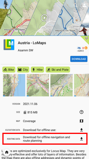
Routing data
The offline version of LoRouter uses offline routing data. We strongly recommend downloading it in advance or you'll be prompted to download additionally while planning a route. You can download it either with the data downloader in settings > Navigation > Router

or as an additional part of LoMaps - routing data is a part of every LoMap package - you can download it from Locus Store:
- open Locus Store
- find a LoMap of the desired area
- download its routing data:
Routing data is automatically updated. You can set the update interval:

GraphHopper
Fast and data-efficient external online router. It offers three bike profiles: cycle, MTB, and racing, two types of walk profiles: walk and hike and a car navigation profile.
With Premium Gold, GraphHopper can render two routes at once, for each route segment individually:
BRouter
FREE option for offline routing. It requires installing an external app.
Setup and data download
- install an external cooperating routing app BRouter, available at Google Play Store >>.
- after installation, launch BRouter

- select Download manager
- zoom in and select the area you need for offline routing

- set BRouter as default router in Locus menu > settings > navigation > router
Profiles
By default, several profiles are available for BRouter in Locus Map. But all of them are editable and you can add more profiles from the BRouter repository or other sources:
- Store the downloaded .brf files into /Locus/router/profiles2 directory
- Edit: select edit from the submenu of the selected profile in the list:

- Add: tap Add new in the topbar:

- fill in the icon, name, category and select source (.brf file):

- tap SET
Not all .brf files in BRouter and other repositories are compatible with Locus Map.
manual/faq/how_to_navigate_offline.txt · Last modified: by mstupka
Except where otherwise noted, content on this wiki is licensed under the following license: CC Attribution-Share Alike 4.0 International
